Documentation
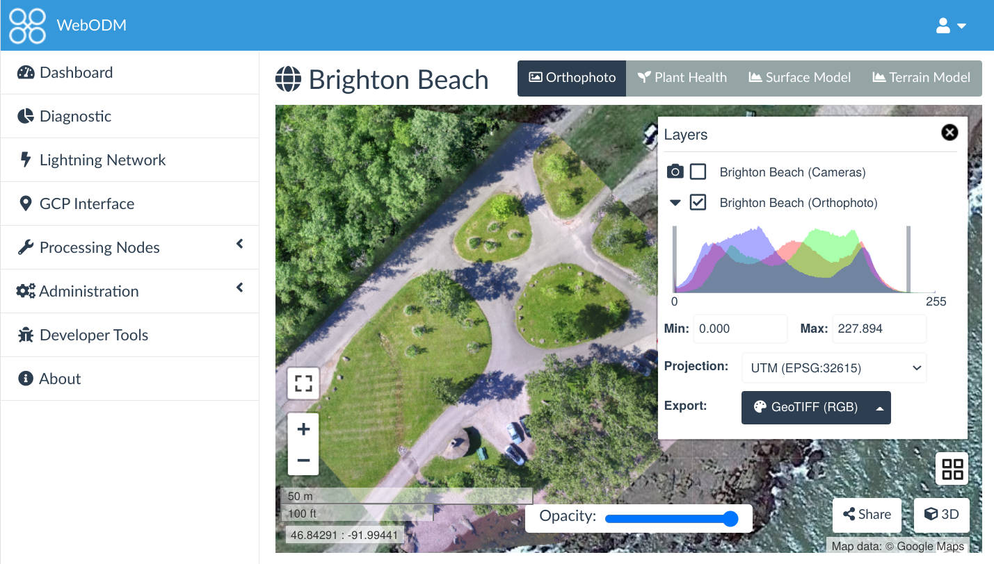
WebODM is a user-friendly, commercial grade software for drone image processing. Generate georeferenced maps, point clouds, elevation models and textured 3D models from aerial images. It supports multiple engines for processing, currently ODX, MicMac and LGT.
Getting Started
Section titled “Getting Started” Installation How to quickly get the software up and running on your machine.
Ground Control Points How to use Ground Control Points
Flying Tips For best in class results
Frequently Asked Questions Check here for answers to frequent questions
Getting Help
Section titled “Getting Help”We have several channels of communication for people to ask questions and to get involved with the community:
License
Section titled “License”WebODM is licensed under the terms of the GNU Affero General Public License v3.0.
Trademark
Section titled “Trademark”Citation
Section titled “Citation”@software{WebODM, author = {Toffanin, Piero and {WebODM Contributors}}, doi = {10.5281/zenodo.3965771}, title = {{WebODM: User-friendly, commercial-grade software for processing aerial imagery.}}, url = {https://github.com/WebODM/WebODM}}Toffanin, P., & WebODM Contributors. WebODM: User-friendly, commercial-grade software for processing aerial imagery. [Computer software]. https://doi.org/10.5281/zenodo.3965771